你好! Shipping to Taiwan with premium packaging for just NT$300 

Ship to
Taiwan
0
  • argentina
  • chile
  • colombia
  • españa
  • méxico
  • perú
  • estados unidos
  • internacional

Select your country

Americas

Europe

Rest of the world

portada Chugach State Park, Anchorage Map
Type
Physical Book
Language
English
Pages
2
Dimensions
22.1x10.9x1.5 cm
Weight
0.14 kg.
ISBN13
9781566956789
Edition No.
2023

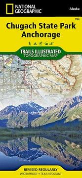
Chugach State Park, Anchorage Map

National Geographic Maps (Author) · National Geographic Maps · Physical Book

Chugach State Park, Anchorage Map - National Geographic Maps

New Book Imported to Taiwan
Delivery: 03 Nov - 12 Nov Shipping: 3 to 5 business days.
NT$ 664
NT$ 664

Synopsis "Chugach State Park, Anchorage Map"

- Waterproof - Tear-Resistant - Topographic MapNational Geographic's Trails Illustrated map of Chugach State Park and Anchorage combines unmatched detail with helpful information to offer an invaluable tool for making the most of your visit to this exciting region. Expertly researched and created in partnership with local land management agencies, this map features key points of interest including Eklutna Lake, Knik River, Penguin Creek, North Fork Eagle River, and the communities of Anchorage, Eagle River, and Alyeska. Portions of Tony Knowles Coast Trail, Iditarod National Historic Trail, and Glenn Highway and Seward Highway scenic byways are shown, as well.Whether you're traveling by horse, skis, snowmobile or on foot, you'll find trails marked according to your desired use. Trail mileage between intersections and handy summaries of Anchorage parks and trails will help you choose the path that's right for you. There is also an elevation profile of Crow Pass Trail. Some of the many recreation features shown include campgrounds, public cabins, yurts, trailheads, interpretive trails, rifle ranges, and river access locations for paddling and fishing. Helpful information about recreation activities available in the region, regulations, and safety tips are included as well. The map base includes contour lines, shaded relief, elevations for summits, and depth soundings and other navigational aids for boating.Every Trails Illustrated map is printed on "Backcountry Tough" waterproof, tear-resistant paper. A full UTM grid is printed on the map to aid with GPS navigation.Other features found on this map include: Chickaloon River, Chugach National Forest, Eklutna Lake, Inner Lake George, Knik River, Matanuska River, Turnagain Arm, Upper Lake George.Map Scale = 1:75,000Sheet Size = 37.75" x 25.5"Folded Size = 4.25" x 9.25"

Customers reviews

Frequently Asked Questions about the Book

All books in our catalog are Original.
The book is written in English.

Questions and Answers about the Book

Do you have a question about the book? Login to be able to add your own question.

Opinions about Bookdelivery

More customer reviews