你好! Shipping to Taiwan with premium packaging for just NT$300 

Ship to
Taiwan
0
  • argentina
  • chile
  • colombia
  • españa
  • méxico
  • perú
  • estados unidos
  • internacional

Select your country

Americas

Europe

Rest of the world

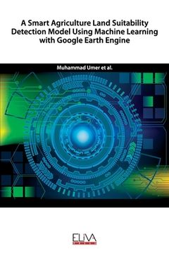
portada A Smart Agriculture Land Suitability Detection Model Using Machine Learning with Google Earth Engine
Type
Physical Book
Publisher
Language
English
Pages
144
Format
Paperback
Dimensions
22.9x15.2x0.8 cm
Weight
0.20 kg.
ISBN13
9781636480121

A Smart Agriculture Land Suitability Detection Model Using Machine Learning with Google Earth Engine

M. Amir Latif (Author) · Muhammad Farhan (Author) · Noor Zaman Jhanjhi (Author) · Eliva Press · Paperback

A Smart Agriculture Land Suitability Detection Model Using Machine Learning with Google Earth Engine - Amir Latif, M. ; Farhan, Muhammad ; Jhanjhi, Noor Zaman

New Book Imported to Taiwan
Delivery: 01 Oct - 14 Oct Shipping: 17 to 21 business days.
NT$ 2,252
NT$ 2,252

Synopsis "A Smart Agriculture Land Suitability Detection Model Using Machine Learning with Google Earth Engine"

The development and growth of plants and crops heavily depend on the number of mineral nutrients and their concentrations available in the soil, moisture in the soil, air quality and water availability. Plants or crops sometimes face challenges in obtaining a sufficient amount of nutrients for the necessary cellular process from the soil due to immobility. The decrease in crops' growth, fertility, or poor food quality happens due to deficiency of natural nutrients, soil moisture, and water, which is required to meet the demand of plants' necessary cellular processes. Lack of nutrients in the soil may result in biodiversity reduction, which directly affects most food webs. This proposed research study will focus on the development of the agriculture land assessment model. Google Earth Engine is a publicly available data repository that hosts an enormous variety of datasets, including climate and weather forecasts, landcover, environmental variables, non-optical and optical wavelengths, water history and classification, and air quality. Precise high spatial resolution cropland extent product up to 60m resolution of very large or even of a specific region of any country is considered very important in addressing several challenges of water security and global food. Cropland products typically cover limited or broad farm areas that are critical for developing specific, higher-level cropland products such as crop irrigation, crop water production, crop intensities, and crop varieties methods. The processing by constructing precision-high resolution cropland-wide training and testing data on diverse geographical locations and safe frontiers, computing capacity, and the management of vast volumes of geographical data are all called challenges. A high-resolution cropland product derived from Sentinel-2 Multispectral (Level-1C) data for different characteristics of Pakistan was produced for the analysis. In this analysis, eight separate Sentinel-2 multi-spectral instruments (level-1C) data from 2018-19 (SWIR 2, SWIR 1, Cirrus, NIR, Red, Green, Blue, and Aerosols) have been used. The pixel-based classification algorithms have been used, and their precision is measured and seen in this study; both computations and analyzes have been conducted.

Customers reviews

Frequently Asked Questions about the Book

All books in our catalog are Original.
The book is written in English.
The binding of this edition is Paperback.

Questions and Answers about the Book

Do you have a question about the book? Login to be able to add your own question.

Opinions about Bookdelivery

More customer reviews