你好! Shipping to Taiwan with premium packaging for just NT$300 

Ship to
Taiwan
0
  • argentina
  • chile
  • colombia
  • españa
  • méxico
  • perú
  • estados unidos
  • internacional

Select your country

Americas

Europe

Rest of the world

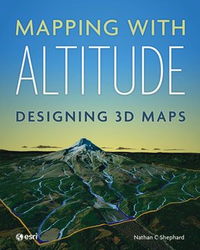
portada Mapping with Altitude: Designing 3D Maps
Type
Physical Book
Publisher
Language
English
Pages
280
Format
Paperback
Dimensions
25.1x20.1x2 cm
Weight
0.68 kg.
ISBN13
9781589485532

Mapping with Altitude: Designing 3D Maps

Nathan C. Shephard (Author) · Esri Press · Paperback

Mapping with Altitude: Designing 3D Maps - Shephard, Nathan C.

Cheaper New Book Imported to Taiwan
Delivery: 26 Oct - 06 Nov Shipping: 13 to 17 business days.
NT$ 2,661
Faster New Book Imported to Taiwan
Delivery: 09 Oct - 19 Oct Shipping: 2 to 3 business days.
NT$ 3,149
NT$ 2,661

Synopsis "Mapping with Altitude: Designing 3D Maps"

Add an extra dimension to your maps.You live in a 3D world--your maps need to be 3D, too. Representing and reviewing data on maps in 3D lets you explore complex spatial relationships in new ways, allowing you to identify patterns and potential problems more effectively. But creating digital 3D maps that are accurate, intuitive, engaging, and easily navigable can seem daunting, even to experienced cartographers.Mapping with Altitude: Designing 3D Maps helps you create clear, compelling cartographic representations in 3D that are both eye-catching and informative. Written by Esri senior product engineer and frequent Esri UC workshop presenter Nathan C Shephard, this book uses a fun and enthusiastic approach to explore the concepts, challenges, and opportunities in 3D cartography.Using easy-to-understand workflows, this book: Shows why some spatial content is best communicated in 3D.Explains 3D mapping concepts, such as surfaces, base heights, texturing, and lighting models.Introduces new twists on well-defined 2D cartographic principles, such as size, color, and text.Demonstrates how the z-dimension can convey time.Discusses the best delivery mechanism for your 3D content.Mapping with Altitude focuses on the practical decisions and specific techniques you'll use as you boldly enter the world of 3D map authoring in ArcGIS.

Customers reviews

Frequently Asked Questions about the Book

All books in our catalog are Original.
The book is written in English.
The binding of this edition is Paperback.

Questions and Answers about the Book

Do you have a question about the book? Login to be able to add your own question.

Opinions about Bookdelivery

More customer reviews